
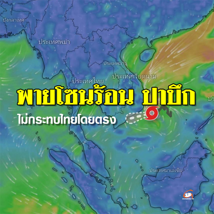
On 25 December 2024, the daily weather pattern shows that a high-pressure area, or cold air mass, continues to cover upper Thailand and upper southern Thailand. Meanwhile, easterly and south-easterly winds are bringing moisture from the South China Sea and the Gulf of Thailand, covering lower northeastern Thailand. This weather pattern results in cool conditions with morning fog in lower northeastern Thailand, with light rain in some areas.
Regarding Tropical Storm "Pabuk" in the lower South China Sea, the Meteorological Department issued Announcement No. 11 (353/2567) stating that at 04.00 hrs. Today (25 December 2024), Tropical Storm "Pabuk" in the lower South China Sea has its centre approximately 460 kilometres east of Ho Chi Minh City, Vietnam, or at latitude 11.1 degrees north and longitude 111.0 degrees east. The maximum wind speed near the centre is approximately 65 kilometres per hour.
This storm is slowly moving westward, slightly to the north, and is expected to approach the east coast of Vietnam. Afterwards, it will weaken into a low-pressure area. This storm will not directly affect the weather conditions in Thailand.
From 25-26 December 2024, easterly and southeasterly winds will bring moisture from the South China Sea and the Gulf of Thailand, covering northern Thailand. Combined with a moderate northeast monsoon, these winds will continue to affect the Gulf of Thailand and the Northeast. This pattern will result in possible rain in some areas of the Northeast, the Central region, including Bangkok and its surrounding areas, and the Eastern region. In the Southern region, rainfall is expected to increase.
Residents in these areas are advised to take care of their health due to changing weather conditions. Farmers should also prepare preventive measures and be cautious of potential damage to agricultural produce during these days.
