
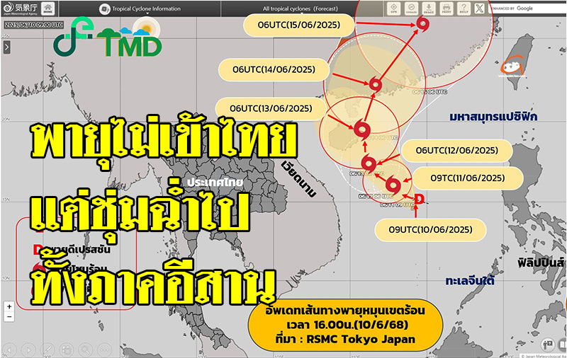
June 11, 2025 at 5:00 AM กรมอุตุนิยมวิทยา Notifications Subject: Depression in the Upper South China Sea No. 4 (138/2568)
At 4:00 AM, Today (11-Jun-20), the depression in the upper South China Sea is centered farther in the direction The southeast of Hainan Island is about 450 kilometers, or at a latitude of 15.5 degrees north, a longitude of 113.0 degrees east. It has a maximum wind speed near the center of about 55 kilometers per hour.
This storm is moving a little bit to the west, a little bit to the north. at a speed of about 15 kilometers per hour, likely to intensify into a tropical storm in the next phase and is expected during the day. June 13-14, 68 will pass through the east of Hainan Island into southern China, after which it will weaken to a depression. and low pressure, strong power, respectively.
byThe center of this pie will not move into Thailand.but may make the southwest monsoon that blows over Thailand stronger, making the areaOn the east side of the northeast, there was an increase in rainfall. And there were some heavy rains.And the winds in the Andaman Sea and Gulf of Thailand will be stronger.
If the situation changes, the Department of Meteorology will notify immediately. Therefore, the public is asked to follow the announcement. from the Meteorological Department closely and can follow the information at the Department of Meteorology website http://www.trnd.go.th or at 0-2399-4012-13 and 1182 24 hours a day.